| ⚡ Quick Answer — Everything About Astore Valley in 30 Seconds ✓ Location: 60 km southeast of Gilgit at Jaglot, Gilgit-Baltistan, Pakistan ✓ Also spelled: Astor Valley — both spellings refer to the same place ✓ Area: 5,092 square kilometres, extending 120 kilometres in length ✓ Altitude: 2,600 to 2,800 metres above sea level (8,530 to 9,186 feet) ✓ Key attractions: Rama Meadows, Rama Lake (3,400m), Rupal Valley, Minimarg (2,844m), Deosai Plains, Rainbow Lake ✓ Distance from Gilgit: 120 km, 4 to 5 hours by road ✓ Distance from Islamabad: 580 to 650 km, 12 to 14 hours via Karakoram Highway ✓ Best time to visit: May to September for trekking, June to August for peak greenery ✓ Winter: Roads close October to March due to heavy snowfall ✓ Permit needed for Minimarg and beyond Chilam: Yes, obtain from FCNA Headquarters in Gilgit |
I planned three days in Astore Valley. I stayed seven. Astore Valley, also spelled Astor Valley in older maps and colonial-era records, is the place experienced Pakistan travellers mention with the particular quiet enthusiasm people reserve for discoveries they are not entirely sure they want to share. It is 60 kilometres southeast of Gilgit. It shares its western boundary with Nanga Parbat, the ninth-highest mountain in the world at 8,126 metres, which is locally called Diamer or the Killer Mountain. Within its borders, you will find Rama Meadows, Rama Lake at 3,400 metres, Rupal Valley, Minimarg village, the Deosai Plains, Rainbow Lake, the Shounter Valley jeep road to Azad Kashmir, and more than 100 villages across an area of 5,092 square kilometres. Furthermore, unlike the Kaghan Valley circuit or Swat, Astore has not yet become the kind of destination where the road up is lined with plastic chairs and generators.
What Is Astore Valley and How Is It Spelled — Astore or Astor?
Astore Valley is a broad mountain valley in the Gilgit-Baltistan region of northern Pakistan, situated in Astore District. It occupies the eastern side of the Nanga Parbat massif and covers approximately 5,092 square kilometres. The spelling question deserves a direct answer because it generates genuine confusion. Both Astore Valley and Astor Valley refer to the same location. The older British colonial maps and many mountaineering expedition records from the 19th and early 20th centuries used Astor as the anglicised spelling. Contemporary Pakistani administrative usage and most modern travel writing use Astore. If your search for information about Astor Valley, Pakistan, lands you here, you are in exactly the right place.
The valley itself has more than 100 villages and a population of approximately 70,000 people, predominantly Shina speakers, with strong cultural ties to Central Asia rather than to the plains of Pakistan.
Geographically, Astore is bordered by Diamer District to the west, Gilgit District to the north, Skardu District to the east, and Neelum Valley in Azad Kashmir to the south. That southern border with Neelam Valley via the Shounter Pass is one of the most dramatic and least-travelled jeep routes in northern Pakistan.
How to Reach Astore Valley Pakistan — Distances and Routes
| From | Distance | Drive Time | Route |
| Gilgit | 120 km | 4 to 5 hours | KKH south to Jaglot, then Astore Road |
| Islamabad | 580 to 650 km | 12 to 14 hours | KKH all the way, then Jaglot turnoff |
| Skardu | 150 km via Deosai | 6 to 8 hours | Deosai Plateau route — 4×4 essential |
| Rawalpindi by bus | Approx. 650 km | 18 to 24 hours | Commuter buses run daily from Rawalpindi to Astore |
Step-by-Step Route From Islamabad to Astore Valley
Step 1: Take the Karakoram Highway northward from Islamabad through Abbottabad, Mansehra, Besham, Chilas, and Raikot Bridge. This is the standard KKH route used by every traveller heading to Gilgit-Baltistan.
Step 2: At Jaglot, approximately 60 kilometres south of Gilgit, turn left onto the Astore Road. This is where the valley officially begins. The signboard is visible from the KKH.
3: Follow the Astore Road through the lower valley. The landscape shifts immediately from the arid KKH terrain to increasingly green slopes as you gain altitude.
Step 4: Astore town is the valley’s administrative centre and your main supply stop. Buy provisions here. Petrol, groceries, and basic hardware are available. Beyond Astore town, supply options thin dramatically.
The nearest airport to Astore Valley is Gilgit Airport. Flights from Islamabad to Gilgit are available through PIA but are weather-dependent. Book with a flexible return date and budget for the possibility of a road return.
Astore Valley is one of several major destinations in Gilgit-Baltistan. Read our complete guide for the full northern Pakistan circuit, including Hunza, Skardu, and Fairy Meadows.
Tourist Places in Astore Valley
This section is the one most travel guides handle with three bullet points and a vague invitation to explore. Instead, here is an honest, practical breakdown of every significant destination within Astore Valley and exactly what each one involves.
Rama Meadows — The Starting Point for Everything
Rama Meadows sits approximately 10 kilometres from Astore town, reachable by jeep on a track that becomes rough in the final stretch. The meadows are lush alpine grasslands bordered by dense pine, cedar, fir, and juniper forests, situated directly beneath the Nanga Parbat massif. This is the valley’s most accessible major attraction. A 4×4 jeep from Astore town reaches it in 30 to 40 minutes. For visitors on a tight schedule, Rama Meadows alone justifies the drive from Gilgit. The view of Nanga Parbat from Rama Meadows at dawn, specifically the moment the first light catches the summit and it separates itself from the dark sky, is something that travel writers consistently fail to describe adequately. It is significantly better in person.
Rama Lake at 3,400 Metres — The Two-Hour Trek
Rama Lake is a glacier lake situated at an altitude of 3,400 metres, approximately 42 kilometres from Astore town and accessible by a 1.5- to 2-hour trek from Rama Meadows. The water is greenish rather than the turquoise you might expect from photographs. That colour comes from the glacial mineral content, and it shifts depending on cloud cover and time of day. The setting of snow-covered peaks reflecting in still water is real and as dramatic as photographs suggest. The wildlife around Rama Lake is the detail most guides mention, and none of them adequately prepare you for it. Ibex, rock partridge, musk deer, and documented snow leopard sightings in the surrounding terrain make early morning the overwhelmingly correct time to arrive at the lake.
Rupal Valley — The Southern Face of Nanga Parbat
Rupal Valley branches from the main Astore Valley and delivers a direct ground-level view of the southern face of Nanga Parbat. The Rupal Face, which rises approximately 4,600 metres from the valley floor to the summit, is the highest rock face in the world. Tarashing is the main village in Rupal Valley and serves as the base camp approach for the Nanga Parbat Rupal Face route. Trekking options from Tarashing include the famous crossing to Fairy Meadows via Mazeno Pass, which is a multi-day route requiring proper mountaineering preparation and a registered guide. For photographers, Rupal Valley offers the most dramatic ground-level composition of Nanga Parbat available from any accessible location. The valley floor sits close enough that the mountain fills the upper two-thirds of a wide-angle frame.
Minimarg at 2,844 Metres — The Village With a Permit

Minimarg is a village in the Minimarg Valley of Astore at 2,844 metres above sea level. It is known for hospitable locals, fertile fields, luminous mountain streams, and a dense pine forest that closes around the village on three sides. The most important practical note about Minimarg: the area beyond Chilam toward Minimarg is a restricted zone requiring a permit from FCNA Headquarters in Gilgit. Process this permit before reaching Astore. Arriving at the Chilam checkpoint without it means turning around.
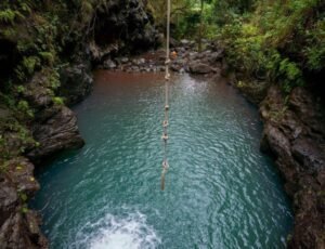
Domel, near Minimarg, contains the Crystal Lake and Rainbow Lake, two of Astore Valley’s most photographically striking water bodies. Rainbow Lake in particular changes colour from turquoise to green throughout the day.
Deosai Plains — The Second Highest Plateau in the World
Deosai Plains, at 4,114 metres above sea level, is the world’s second-highest plateau and spreads across 3,000 square kilometres. It is accessible from Astore via a rugged jeep track requiring a proper 4×4 vehicle. The Plains are famous for their wildflower carpet from June to August, when hundreds of species bloom simultaneously across an unbroken high-altitude grassland that looks unlike anywhere else in Pakistan. Wildlife here includes the Himalayan brown bear, Tibetan wild ass, snow leopard, golden eagle, and Sheosar Lake with its flamingo-pink flamingos in certain seasons. Deosai can also be reached from Skardu on the other side, which makes it a natural connecting point for an Astore-to-Skardu route via the plateau. That route takes 6 to 8 hours from Astore town to Skardu and is one of the most spectacular drives available in Gilgit-Baltistan.
Shounter Valley — The Least Known Route
The Shounter Valley road connects Astore Valley to Neelum Valley in Azad Kashmir, crossing the Shounter Pass at 3,800 metres. This route is classified as an adventure jeep track rather than a standard road. The Astore-Shounter Valley road starts from the Kel area in Neelum Valley and rises to Shounter Pass before descending into Astore. It is less demanding than the highest mountain passes of Gilgit-Baltistan but significantly more adventurous than the main Astore road.
This is the route that experienced northern Pakistan travellers choose when they want to see Astore Valley from an entirely different angle. Very few travel guides mention it. That gap is the reason the road still feels like a discovery.
The Shounter Valley road connects Astore to Neelum Valley in AJK. Read our Neelum Valley guide for the complete picture of the Kashmir side.
Astore Valley Weather and Temperature
The valley sits at 2,600 to 2,800 metres, which produces a climate that is significantly cooler than the Pakistani plains year-round. However, within that altitude range, there is meaningful seasonal variation that determines whether your trip is comfortable, spectacular, or impassable.
| Month | Temperature | Conditions | Verdict |
| Jan to Feb | minus 10 to 0°C | Complete snow cover, roads closed | Winter isolation. Only reachable by experienced mountaineers. |
| Mar to Apr | 0°C to 10°C | Snow melting, road conditions uncertain | Check road status daily. Lower valley only. |
| May | 10°C to 20°C | Spring wildflowers, Rama track opening | GO. Spectacular wildflowers. Fewer visitors than peak summer. |
| Jun | 15°C to 25°C | Full green. All routes open. | GO. Deosai wildflowers peaking. Rupal Valley fully accessible. |
| Jul to Aug | 18°C to 28°C | Peak summer. Warmest and busiest. | GO. Best for trekking. Book accommodation 2 to 3 weeks ahead. |
| Sep | 12°C to 22°C | Monsoon clearing. Autumn beginning. | Excellent. Quieter than July, still fully accessible. |
| Oct | 5°C to 15°C | Autumn foliage. Early snowfall possible. | Last window. Go before November. Spectacular colour. |
| Nov to Dec | minus 5°C to 5°C | Roads are closing due to heavy snowfall | Season end. Do not plan without confirmed road status. |
Temperature at altitude: Rama Lake at 3,400m is consistently 5 to 8 degrees colder than Astore town. Pack for at least 5°C below whatever the valley forecast says. Nights at Rama Meadows drop sharply even in July.
Trekking in Astore Valley

Astore Valley is a trekker’s destination first. Understanding which routes match your fitness level before you arrive saves both time and the specific disappointment of realising at the trailhead that you are underprepared.
Easy Treks — No Technical Experience Required
• Rama Meadows to Rama Lake: 1.5 to 2 hours one way, moderate elevation gain, well-worn trail through pine forest. This is Astore’s introductory trek and the right starting point for any first-time visitor.
• Astore town to Rama Meadows walk: If you want to avoid the jeep track, the walking route through lower meadows takes 3 to 4 hours and provides valley views the jeep track misses.
Moderate Treks — Fitness Required, No Specialist Gear
• Tarishing to Rupal Valley base: A full-day route into Rupal Valley providing the closest accessible views of the Rupal Face of Nanga Parbat. A guide from Tarishing is strongly recommended.
2) Astore to Skardu via Deosai Plateau: A multi-day jeep route that passes through Deosai at 4,114m. Physically manageable, but altitude sickness is a real possibility without proper acclimatisation.
• Rainbow Lake and Crystal Lake via Minimarg: After obtaining the permit, the walk to Domel and the lake area from Minimarg takes 2 to 3 hours and rewards with colour-changing lake formations.
Strenuous Treks — Guide and Preparation Mandatory

Trekking to Fairy Meadows via Mazeno Pass: A multi-day crossing requiring a registered guide, porter, and full camping equipment. One of the classic northern Pakistan mountain routes. Not to be attempted without proper preparation.
• Astore to Neelum Valley via Shounter Pass: A technical jeep and trekking route crossing at 3,800 metres. Requires a 4×4 vehicle, an experienced driver, and confirmation of Shounter Pass conditions before departure.
• Nanga Parbat Base Camp via Rupal Face: A multi-day technical approach. Permits and a registered guide are legally required. Contact the Gilgit Baltistan Tourism Department for current permit requirements and costs.
Best Hotels in Astore Valley
Accommodation in Astore Valley is not extensive. Knowing the honest options before you arrive prevents the frustration of discovering that the hotel you planned to use has no vacancies or no hot water.
Rama Area — Best Location for Trekkers
PTDC Motel Rama is the gold standard for Astore Valley accommodation. It provides the best balance of location, facilities, and reliability. Booking through PTDC is essential for July and August. Kamran Hotel is an alternative for visitors who cannot get a PTDC room. Rama PWD Rest House and Madina Green Palace Hotel round out the options in the Rama area. All are basic by city standards and excellent by mountain standards. Hot water and a bed after a day at Rama Lake are genuinely all you need.
Astore Town — Practical Base
Astore town has several mid-range hotels serving as the valley’s practical commercial hub. Staying here is the right choice if your itinerary covers multiple destinations within the valley and you want a central base with market access. From Astore town, Rama Meadows is 30 to 40 minutes by jeep. Rattu and the Deosai route are accessible in the other direction. Town accommodation is functional and significantly cheaper than Rama area options.
Minimarg — For the Adventurous
Minimarg has limited guesthouse options available through local arrangements. Given the permit requirement and the road condition, staying overnight in Minimarg rather than day-tripping from Astore town is the choice of serious trekkers with multiple days to dedicate to the upper valley.
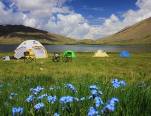
| 🏨 Practical Hotel Tips for Astore Valley:y Book PTDC Motel Rama at least 3 weeks ahead for July and August weekends — it is the most in-demand accommodation in the valley. Most hotels in Astore town accept walk-in guests without reservations outside peak season. Confirm hot water availability before committing. At this altitude, a cold shower in October is a genuine hardship. Generators are the electricity source for most accommodation above Astore town. Power outages are normal and not the hotel’s fault. Camping at Rama Meadows and Rama Lake is permitted and is the accommodation choice of most serious trekkers. Bring all equipment from Gilgit or Islamabad. |
What Astore Valley Gets Right and Where It Falls Short

Every travel guide about northern Pakistan describes places as hidden gems. Most of them are no longer hidden. Astore Valley is one of the few that still earns the description.
Moreover, the reason it has stayed relatively uncommercialized is that it is hard to reach. It is because the permit requirement for Minimarg and the 4×4-only upper valley filter out casual visitors naturally.
What the Valley Genuinely Delivers
• The Rama Meadows view of Nanga Parbat at dawn is singular. There is no other accessible location in Pakistan where you stand that close to an 8,000-metre peak with that clear a sightline.
• Rama Lake at 3,400 metres is a legitimate high-altitude glacial lake experience accessible to any reasonably fit visitor on a moderate two-hour trek.
3. Wildlife density in this valley, particularly around Rama Lake and the Deosai approach, is among the highest in northern Pakistan. Snow leopard sightings, while rare, are documented here.
• The cultural character of Astore, with its Shina-speaking Sunni communities and strong Central Asian cultural ties, provides an experience distinct from any other Pakistani valley.
• Connecting routes to Skardu via Deosai and to Neelum Valley via Shounter Pass make Astore a genuine hub rather than a destination cul-de-sac.
The Honest Gaps
• Mobile phone coverage essentially ends after Astore town. A land phone system serves some upper valley areas. Inform your family of your route and check-in plan before entering the upper valley.
• The permit requirement for Minimarg catches unprepared visitors at the Chilam checkpoint. This happens frequently and consistently. Process the permit from FCNA Headquarters in Gilgit before arriving.
3. The road condition beyond Astore town degrades sharply and requires a 4×4 vehicle. A Corolla or Mehran will not manage the upper valley jeep tracks regardless of what local fixer services might suggest.
What People Who Have Actually Been To Astore Valley Pakistan
| Trekker, Lahore — July Visit ★★★★★ I planned two days in Astore and spent six. Rama Meadows at dawn on day two with Nanga Parbat fully visible in early morning light is the single greatest natural view I have experienced in Pakistan. I have been to Hunza, Skardu, Fairy Meadows, and Naran. A store at that moment was better than all of them. The PTDC Motel was fully booked, and I ended up camping near the meadow. That turned out to be the better option. |
| Couple Trip, Islamabad — September ★★★★★ September is the right month. The July crowds had cleared. Rama Lake had us completely alone for an hour after the short morning trek. The water level was at its highest post-monsoon,n and the reflections were the best I have photographed anywhere. |
| Group of Four, Gilgit Base — August ★★★★☆ We attempted Minimarg without realising the permit was mandatory. Turned around at Chilam checkpoint after a 3-hour drive. Get the permit from FCNA in Gilgit before you leave. It is straightforward to obtain, but it cannot be done at the checkpoint. That one mistake cost us a day. Rama Meadows and Rupal Valley more than compensated. |
| Solo Traveller, Foreign Visitor ★★★★★ I reached Astore overland from Gilgit and spent 10 days exploring independently with hired local jeeps for the upper valley sections. The locals in every village, from Astore town to Tarishing to the Rama area, were consistently welcoming. The Shina language is completely different from Urdu, but the communication barriers people warned me about did not materialise. |
Permits Required for Astore Valley
This section prevents the most common and avoidable mistake first-time Astore Valley visitors make.
| Area | Permit Required? | Where to Obtain |
| Astore Town and Rama Meadows | No — freely accessible | No permit needed |
| Rupal Valley and Tarishing | No for general access | Nanga Parbat BC trek requires guide registration |
| Minimarg, Domel, Chilam onwards | YES — mandatory | FCNA Headquarters, Gilgit. Obtain before leaving Gilgit. |
| Deosai Plains via Astore | Entry fee applies | Deosai National Park fee at entry gate |
| Shounter Pass to Neelum Valley | Confirm before travelling | Check current requirements with FCNA Gilgit |
| ✅ Before You Leave For Astore Valley — 10 Non-Negotiables 1. Get the Minimarg permit from FCNA Headquarters in Gilgit BEFORE you leave Gilgit. No exceptions. 2. Confirm vehicle type. Astore town is reachable in a sedan. Rama Meadows, Minimarg, Deosai, and Rupal require a 4×4 jeep. 3. Carry enough cash for the entire trip. ATMs do not exist beyond Astore town. 4. Fill petrol in Astore town. This is your last reliable fuel stop. 5. Download Google Maps offline for the Jaglot to Astore to Rama route before you lose signal. 6. Bring warm sleeping gear regardless of month. Nights at Rama Meadows and Rama Lake drop sharply. 7. Book PTDC Motel Rama at least 3 weeks ahead for July and August visits. 8. Tell someone your exact route and expected return date before entering the upper valley. 9. Carry water purification tablets. Glacier stream water looks clean. Treat it regardless. 10. Altitude sickness is real at 3,400 metres. Acclimatise properly in Gilgit or Astore town for one full day before pushing to Rama Lake. |
Frequently Asked Questions — Astore Valley, Pakistan
Astore Valley is located in Astore District, Gilgit-Baltistan, northern Pakistan. The valley entrance is at Jaglot on the Karakoram Highway, approximately 60 kilometres southeast of Gilgit. It extends 120 kilometres in length and covers 5,092 square kilometres.
Astore Valley is approximately 580 to 650 kilometres from Islamabad by road via the Karakoram Highway. The drive takes 12 to 14 hours to reach Astore town. Most visitors break the journey with an overnight stop in Chilas or Gilgit.
May to September is the accessible window for Astore Valley. June to August offers peak greenery, all routes open, and the best conditions for trekking.
The main tourist destinations in Astore Valley are Rama Meadows, Rama Lake at 3,400 metres, Rupal Valley, Minimarg village at 2,844 metres, Rainbow Lake and Crystal Lake near Domel, Deosai Plains, Rattu area, and the Shounter Valley jeep route to Neelum Valley in AJK.
The main accommodation options are PTDC Motel Rama, Kamran Hotel, Rama PWD Rest House, and Madina Green Palace Hotel in the Rama area, plus multiple mid-range hotels in Astore town. Camping at Rama Meadows and Rama Lake is permitted and is the preferred option for most serious trekkers.
Yes. The Astore to Skardu route via Deosai Plains covers approximately 150 kilometres and takes 6 to 8 hours.
Deosai Plains is accessible from Astore Valley and deserves its own dedicated day. Read our complete Deosai guide for the wildflower season, wildlife, and Sheosar Lake.
Final Thoughts — Why Astore Valley, Pakistan, Deserves More of Your Time

The valleys that stay honest the longest are the ones that ask something of you before they reveal themselves. Astore Valley asks for a longer drive, a permit from a government office in Gilgit, a willingness to swap hotel comfort for a tent on a meadow, and more time than you initially planned to give it. In return, it gives you Nanga Parbat at dawn from Rama Meadows, a lake at 3,400 metres with snow leopard habitat on three sides, a plateau that is the second highest in the world, and villages where the Silk Road trade routes once passed and where locals will still tell you about Srinagar with the familiarity of a city they know personally. Plan for five days. Take seven if the valley allows it. Get the Minimarg permit from Gilgit before you enter the valley. Bring your own tent if you want the best accommodation the valley offers. After all, the plan changes anyway. That is what Astore Valley does.
Read next: Our complete guide to Deosai Plains, the world’s second-highest plateau accessible from Astore Valley, with the wildflower season, Himalayan brown bears, and Sheosar Lake covered in full detail